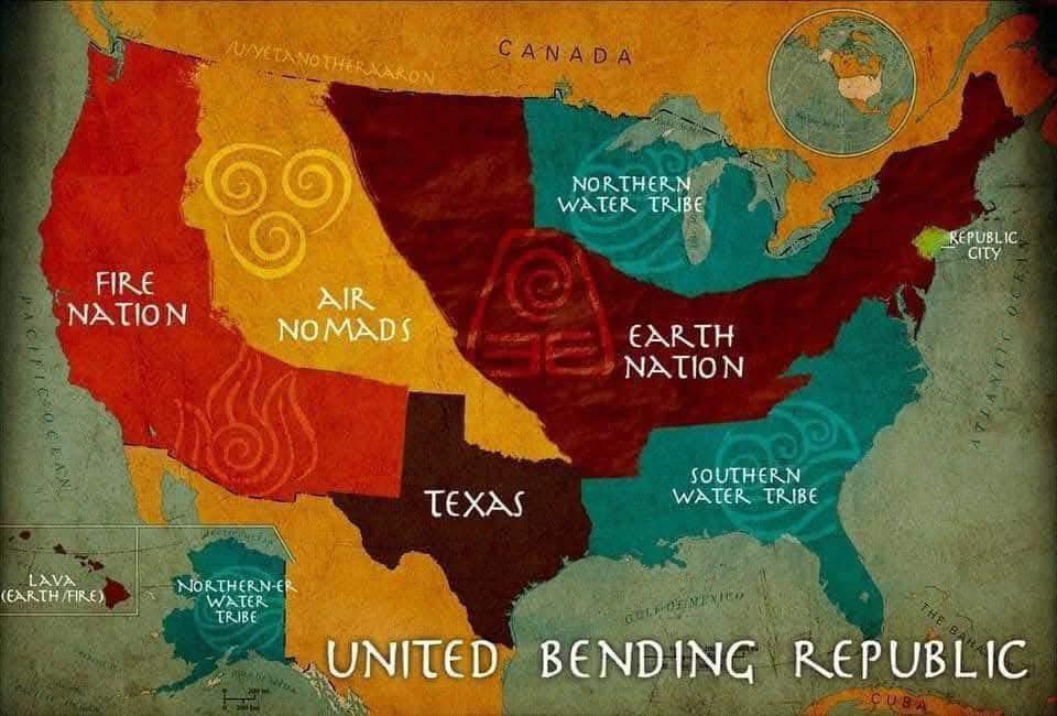
American region names don’t match up to physical locations too well.
The “south” is generally the soitheastern states that were part of the Confederacy in the Civil War. In other words, the slave-owning states that tried to break away from the rest of the country in 1860. Arizona and New Mexico (the bottom right part of the Fire Nation) may be in the geographal south, but they are definitely not part of “the south.” They had no involvement in that Civil War stuff. We call those the Southwest or the Desert Southwest. The souuthwesternmost part of the country, however, is definitely not part of the Southwest. That’s just Southern California.
Texas was part of the Confederacy, but Texas is Texas. It’s just kind of its own thing. The east/southeast part of Texas is culturally “southern” in many ways, but its Texas-ness supersedes its southern-ness. Just ask any Texan. 🤠
Note that the northern edge of what we technically consider the south is called the Mason Dixon Line, and it’s located right around the top of that weird-looking peninsula that’s a little below Republic City. Geographically, that’s pretty damn far north. And because things can’t be simple, both the cultural southern-ness, slave- owning status as of 1860, and actual ultimate involvement in the Civil War is pretty fuzzy along the northernmost part of the South. There are other exceptions too, but I’ve gone on long enough.
I do want to add that I find this map absolutely baffling.
502
u/willowdove01 5d ago
I appreciate that Texas is just Texas lol. Would think the Air Nation would line up more with Tornado Alley though