r/vancouverhiking Jan 16 '21

Safety Vancouver Hiking Resources Page

46 Upvotes

The following is a series of helpful resources. Please comment bellow for other resources, and categories that should be here.

How to Get Started

  • How Much Should the Ten Essentials Cost - $70, though many items can be pulled from your home.
  • Best Beginner Hikes: Dog Mountain, Jug Island, Grouse Grind, BCMC Trail, Pump Peak, Stawamus Chief, Sea to Sky Gondola are all great first hikes. They are very generally busy and well marked.
  • Hiking Trails You Can Access with Transit - Blog/Search Filter - Lonsdale Quay has buses going to Grouse Mountain ( Grouse Grind, BCMC, Flint and Feather, Baden Powell, Goat Peak, Hanes Valley) and Lynn Canyon ( Needle Peak, Norvan Falls, Lynn Canyon, Hanes Valley) Lions Bay has a bus that drops of close enough to the trailheads for Tunnel Bluffs, Lions, Mt. Harvey, Mt. Brunswick, portions of the Howe Sound Crest Trail. Quarry Rock is near the Deep Cove bus stop.
  • How to Dress For Different Conditions/ Layers - Website- Excellent simple info on how to dress and what to wear. Footwear is also really important. You may not need huge hiking boots, but proper traction should be considered essential.
  • Timing Hiking For Your Safety- Reddit Post
  • BC Mountaineering Club, Alpine Club of Canada, Varsity Outdoor Club - For a $50 these clubs offer group trips to various locations. Sign up is on their website. Trips are organized by experience level. While legally they are organized, not guided trips, most trip leaders are happy to offer advice and minor instruction. It can be a great place to find friends.
  • ACMG Guides - are a really good way to quickly learn skills. They are pricey, but you can learn much faster then being self taught. Most trips starts at $200. Altus and Coast Mountain are great. Taking courses is also a great way to meet other people.
  • 103 Hikes in SW BC, and it's successor 105 Hikes in and around SW BC - The classic Guidebook. Very well written, and a good deal more reliable than many other websites.
  • Glorious Northshore Mountains - Guidebook A guide of hikes and scrambles for scrambling in the North Shore. It includes a lot of info on lesser climbed peaks like Cathedral.
  • Vancouvertrails.com - Website-Excellent website with guidebook quality writeups for the most part.
  • Vancouver Trails - Blog- has the best straight forward safety advice for the local mountains.
  • Ben Gadd's Canadian Backpackers Handbook - Instruction Book - If you are at all nervous, but curious about getting into hiking this book is worth every penny. It is packed with good advice and contextualizes all the little details. It also is summed up with a nice little narrative that demonstrates how a myriad of approaches to backpacking come together. It's refreshingly not preachy, or single minded. Well produced, and a delight to read.
  • Scrambles in SW BC - Guidebook - Out of print, but if you can find a copy it is an excellent guidebook if you're looking to do more challenging routes, and summit peaks. Many of the routes are hikes that are poorly marked.
  • Wilderness First Aid - If you are spending more than 15 days a year out in the backcountry it is worth investing in Wilderness First Aid within a year of starting hiking. A First Aid kit is only useful if you know what to do with it.

Trip Planning

  • BC AdventureSmart - App and Website
  • Hiking Gear List - Website - List of relevant equipment for our area. Bottom of the page has a link you can get a Word doc checklist from.
  • Avalanche Canada Trip Planner - Conditions Website - Shows avalanche terrain complexity for most areas. Look for Black Icons that look like chinese characters. Click on them to see recent temperatures, wind speed and direction and rough snowfall. Blue icons are user submitted information. Inconsistent and jargon heavy, but the photos are still useful for entry level users.
  • Fatmap - Website - Great alternative to google earth as it shows trails along with a few more handy features, like winter and summer maps. The elevation tool is really helpful for learning how to use topographic maps. Trails often are shown, but it's newer to the area so actual guidebooks are fewer. Full disclosure I write for Fatmap, and receive compensation.
  • Alltrails - Website - A great resource for finding conditions as it is the most popular user generated hiking info site for Vancouver. Also very helpful for finding less travelled routes, or overlooked gems. Just be warned as the info is not always accurate, and people have gotten into trouble follow tracks from the website.
  • Outdoor Project - Website- Not much coverage for our area, but content is guidebook quality.
  • The Outbound - Website - Inconsistent user submitted trip aggregator.
  • Clubtread- Forum -Old school forum that has fallen out of regular use. Really good community with lot's of helpful long form trip reports.
  • Ashika's site has an even more thorough list of resources. Some helpful advice for those adventuring with diabetes as well.

Weather Websites

  • Mountain Weather Forecast - Easiest to use. Just type in the peak or a peak nearby to get a forecast, and then select the elevation for the forecast.
  • SpotWX Weather - Great little tool that allows you to drop a pin and the select a weather model to predict the weather for a specific area. The most accurate in my experience
  • Snow Levels Satellite Imagery by date - Good for getting a rough idea where snow levels are at.
  • Howe Sound Marine Forecast - Can be quite helpful if you are hiking along the How Sound. Generally the wind the stays bellow 1000m, so don't be as concerned about the wind speeds.
  • Windy.com - Has a helpful live temperatures, and live webcam options on a map. Similar to SpotWx takes some time to understand, but is the best tool for learning how pressure systems interact, and can be handy for developing your own understanding of how to predict mountain weather. Click to get a localized forecast in graph form.
  • Association of Canadian Mountain Guides Condition Reports - Website - Infrequently updated on the Coast. Very helpful info though, with thorough info.

Navigation

Gear

Winter Skills

  • Freedom of the Hills - Book - Mountaineers press is based in Washington so their advice, while general is a little biased to our conditions.
  • British Mountaineering Council Skills Videos - Great introduction to some elements of mountaineering. Bear in mind the theUK (Scotland) gets very different conditions. Constant wet winds and total lack of trees means they get icy slopes where crampons and ice axes are necessary. Here we just get lot's of snow, and then more snow. Skis are hands down the best method of travel. Snowshoes come second. Most of the winter mountaineering advice is actually more relevant in summer in these parts.
  • Seasonal Snow Levels - Curious about the general snow line and how it changes throughout the year.

Avalanche's


r/vancouverhiking 3d ago

Trip Reports Upper Pierce lake August 31 2025

Thumbnail
gallery
104 Upvotes

Arrived at the parking lot at around 9am. The lot was almost full but I managed to find a spot.

Most hikers on the road were overnight campers and I only saw two to three day hikers like me.

Took around 1.5 hours to get to the bridge on Pierce Creek, then another 1.5 hours to get to Lower Pierce lake. Some people were camping there.

After another 1.5 hours, finally got to the upper Pierce lake. Did not try summit Mount Macfarlane as it was a bit late for me.

My giagps recorded 18.89km which is longer than those numbers on alltrails: 15.4km.


r/vancouverhiking 14h ago

Leave No Trace Etiquette

Thumbnail
gallery
69 Upvotes

Hey fellow hikers, let’s talk about something important: please don’t defecate along the side of the road or trail. It’s not just gross—it’s a serious health risk for everyone. Human waste can carry pathogens like bacteria (e.g., E. coli and Salmonella), viruses (like norovirus or hepatitis A), and parasites (such as Giardia or Cryptosporidium) that spread through contact or contaminated water sources. When feces aren’t properly buried or packed out, rainwater can wash them into streams, rivers, or groundwater, leading to waterborne illnesses that affect hikers, wildlife, and even downstream communities.

​


r/vancouverhiking 21h ago

Photography Lady Peak, Chilliwack

Thumbnail
gallery
81 Upvotes

Gorgeous conditions during one of my Labour Day long weekend hikes. My group of 3 advanced hikers, myself included, made it to the upper Chipmunk Creek FSR parking lot just before 9am and were rewarded for our efforts with these stunning views just before noon.

A few things to note if you want to hike Cheam or Lady Peak:

•have a capable vehicle with AWD or 4x4 and some ground clearance. The FSR isn’t the most challenging but it is steep and has some deep ruts

•there were countless annoying flies at the peak so being bug spray

•the parking lot fills up quick on the weekends so being bug spray sure to arrive early (before 9am)


r/vancouverhiking 17h ago

Trip Suggestion Request Manning. Thunder Lake to SkyLine II possible?

Post image
13 Upvotes

I'm curious if anyone has done Thunder Lake to the Skyline II trail? It seems such a natural trail to do (or build) as it would provide a really nice loop from the Skyline trail around Mowich camp back past all the lakes.

So, you'd take the Skyline II trail one way and then switchbacks down to Thunder Lake and the lake route back the other after a night at Mowich.

I didn't have time to investigate on my August trip, but wondering if there are any goat trails or unofficial trails that take that route?

The green line is a potential route I was wondering about. the bottom connects to the Manning Thunder Lake trail and the top is close to Lone Goat on Skyline II.


r/vancouverhiking 17h ago

Trip Suggestion Request looking for good 4th class scrambles to practice on near vancouver

11 Upvotes

(I'll put a tldr at the end)

hey guys, wanted to know some good 4th class scrambling somewhere in greater Vancouver area (squamish-maple ridge). preferably something lower down so I can practice at a higher energy level.

Went for a day trip on Robie Reid last week and bailed after the chimney. I'm pretty experienced at indoor climbing (v6-7 climber), but in hindsight ive realized that the mindset it out me in was quite counterproductive for scrambling. Robie Reid didn't really have any good holds. it was just a 70° slopey no fall zone. I think I know how to do that kind of stuff after having given it a lot of thought and was wondering if anyone has good suggestions in the area that I could use to practice more. I've already done the west lion which felt a LOT easier. Please let me know if you're planning to do anything that you suggest in the near future if you'd be willing to let me join you

tldr: bailed on Robie Reid and need some good similar difficulty scrambles to practice


r/vancouverhiking 1d ago

Mountaineering Mt Garibaldi via NE Face - August 7-8th

Thumbnail
gallery
179 Upvotes

Mt Garibaldi summit about a month ago that I never got around to posting.

Day 1 we hiked up-to Brohm Ridge after a questionable FSR for a SUV. Hiked through the clouds and bivyed right below the foot of the glacier.

Day 2 Slept about 5 hours before leaving for the summit around 3:00am. After packing up, cooking and eating, we roped up and began the glacier travel. Start of glacier (1-200m) was a heavy rockfall zone (heard rocks tumbling all night and through the day) so we moved quick. crevasses were wide open except one which we identified and avoided. Upon reaching the headwall, i grabbed all the pro and led up as we simul climbed it due to relatively easy terrain, and despite being just 6am by the time we reached it snow was softening so we moved quick before it got softer. Reached the summit and began descending quick. We decided to make a natural anchor around a large boulder and rappel down the steep upper section due to super soft snow before downclimbing the rest. Roped back in for glacier travel, descended quick and made it back to the car. We were extremely lucky weather wise picking a window that should have been cloudy yet seemed to clear up just for our climb.

We are both pretty physically fit so we did it relatively quick, requires glacier navigation, crevasse rescue skills, and a tiny bit of ropework.

pictures in order, 1. taking a break pre headwall, 2. photo from glacier at sunrise, 3. traversing brohm ridge, 4. Looking up at summit from glacier, 5. looking up at summit from bivy, 6. photo from summit


r/vancouverhiking 22h ago

Conditions Questions (See Guide before posting) hiking in vancouver despite smoky conditions

10 Upvotes

Hi everyone! I’m visiting Vancouver just for the weekend and hoping to fit in a couple of hikes despite the smoke. Do you have any recommendations for trails where the views are still worth it? I know visibility won’t be perfect, but I’d love to get out and see as much as I can. Thanks!


r/vancouverhiking 22h ago

Conditions Questions (See Guide before posting) Wedgemount lake hike

4 Upvotes

I am hoping to hike wedgemount lake tomorrow but I’m concerned about the smoke. Would you guys recommend it?


r/vancouverhiking 1d ago

Trip Suggestion Request Elfin Lakes/Diamond Head parking overnight

7 Upvotes

We have an overnight reservation at Elfin Lakes Shelter for 6 people for 2 nights. We all want to get there at different times so we are wanting to go in 3 cars. Will this be an issue to have 3 cars get through the checkpoint at the top with the same reservation or are they only focused on the number of people?

Secondly, one member is only staying for 1 night and our reservation is for 2 so one person is hiking down after night 1 and another friend is coming up for night 2. Will the second person have any issues being allowed up?

Really my question is, do they just check you have a reservation and let you through or do they record that you have checked in with the appropriate amount of people?

And if worse case scenario they don't allow some of us up, can we park in the parking lot a couple of kilometers down and hike/bike up past the checkpoint?


r/vancouverhiking 1d ago

Safety Is this bear scat?

Post image
56 Upvotes

First time seeing it so wanted to confirm. Looks similar to some pictures I can find online, but also aware it can be mistaken - and it kinda doesn’t look big enough.

Taken on the Grouse Backside, heading from the Peak down to the Alpine Trail.


r/vancouverhiking 23h ago

Conditions Questions (See Guide before posting) Elfin Lakes/South Garibaldi Park Smoke

4 Upvotes

Hello, has anyone recently gone to Elfin Lakes or any spot in the area? A bit concerned with the higher smoke intensity of the last day, since friends and I have a backpacking trip this weekend, hopefully the AQHI index will be lower


r/vancouverhiking 1d ago

Multi-day Trips Saltery Bay Hut Question

2 Upvotes

Hey!

I'm planning on doing the Saltery Bay loop this weekend on Sunshine Coast and staying in the huts. Just wondering if anyone has experience with how busy its been lately?

Since the huts and first come first serve, what happens if its already taken when we get there? Should I bring a tent in case?

Thanks!


r/vancouverhiking 1d ago

Weekly Trip Plan/Conditions Question Thread Reminder: Fondo happening on Saturday Sep 6

50 Upvotes

Just a friendly reminder that going up the Sea to Sky Highway will be a sub ideal choice for Saturday due to the Gran Fondo.

https://www.rbcgranfondo.com/event-resources/whistler/traffic-advisories

I almost forgot about it while planning for the weekend…


r/vancouverhiking 1d ago

Conditions Questions (See Guide before posting) Whistler Mountain/High Note Traile 4th September

6 Upvotes

Hi Everyone,

I’m from the UK in Vancouver for the first time and have bought a bus ticket with the intention of hiking whistler mountain & the high note trail tomorrow. After reading some of the news stories about the smoke in the region is it still safe to do this? Will the views be pretty terrible as a result of the smoke?

Will be really disappointed if I can’t make it. Any advice or maybe alternatives would be much appreciated (no car, public transport only)


r/vancouverhiking 2d ago

Trip Reports Golden Ears Summit - August 26

Thumbnail
gallery
181 Upvotes

This one has been on my bucket list for a long time living in the area. My goal this summer was to complete this one, Brunswick and panorama ridge, so I’m glad I got this one in to complete the trio. Definitely the toughest hike I have done but well worth it. The terrain is so technical for a large portion of the hike that you move very slowly, even coming down. It took us 5 hours up; we could have been much faster but we met up with a guy who needed help with the trail and then water filtered. We stuck with him for the final scramble to the summit after the shelter to be safe. The scramble was way easier than I expected. There was never a part where I felt unsafe or exposed to a fall. Staying on trail was fairly easy for this part but having AllTrails pro was nice for an offline map. There are a lot of orange markers or ribbons to keep you on track but you can choose your own way up for a lot of it. There is a nice cold creek at the emergency shelter near the summit. No water between alder flats and the shelter creek. We took the East canyon route and connected via the bridge rather than the traditional west canyon way. I think the length is the same but the terrain is supposed better on the east canyon which was nice for the last 4km when we were exhausted. I haven’t been on the west canyon trail so I can’t compare. Coming down from the summit was honestly worse than the ascent because of the terrain and how frustrating it is moving at snail pace down rocks. You will be in the sun for a long time on this hike. Bugs were non existent. Overall, this was a fantastic hike but not for everyone


r/vancouverhiking 2d ago

Trip Reports Capilano mountain

Thumbnail
gallery
109 Upvotes

r/vancouverhiking 2d ago

Trip Suggestion Request Cheam peak overnight camping

8 Upvotes

I have hiked Cheam Peak in 2023 and I loved it. This year I’m going to do it again this time I’m wondering if doing overnight camping at Cheam peak is allowed, which I highly doubt. And in case it’s allowed is it safe to do overnight camping there?


r/vancouverhiking 1d ago

Trip Suggestion Request Help Us Choose a Hike

0 Upvotes

Wife and I will be visiting Vancouver next week and would like to spend one day hiking. We’re staying at the Pinnacle Harbourfront and won’t have a car. I’ve done some research and was considering either Lynn Canyon, Quarry Rock or Grouse Mountain but would be open to other suggestions. Thoughts?


r/vancouverhiking 2d ago

Conditions Questions (See Guide before posting) Panaroma ridge - weather question

Post image
3 Upvotes

Hi everyone,

Would hiking Saturday be clear? Obviously Friday is ideal but not sure if that is possible for us but debating if we should make it work or do you think we will have a clear view on Saturday?


r/vancouverhiking 2d ago

Looking for hiking partner Up for a hiking daytrip?

21 Upvotes

Hi, I’m 22/f from Germany and I am looking for a hiking buddy (or hiking group) during my trip to Vancouver. 🏔️ Show me your favourite hike in the area? Try a trail together you’ve always wanted to do but haven’t so far? 💫 Looking forward to exploring some beautiful places and meeting friendly new people 🥰

I’ll be in the city from September 10th (Wednesday) till September 12th (Friday).

Down for moderate hikes (technically preferably rather easy; 4-6 h max; altitude difference up around 600 m)


r/vancouverhiking 2d ago

Looking for hiking partner Anyone hiking Panorama Ridge/Garibaldi Lake over the weekend (6-7 sept)?

6 Upvotes

I was lucky enough to secure a booking for Helm Creek campground for Saturday night (6 september) and would love to join fellow hikers on the trail (happy to tag along if you're only there for the day, whether it is saturday or sunday). I moved to BC earlier this year and can't get enough of the hikes around here!

I'd love to do the one-way route (or alternatively starting/finishing from one point, either Lake Cheakamus or Rubble Creek) but it proves challenging all by myself so if anyone is planning any of those trips and would be happy to have a +1 in their group, I'd love to share that journey with you

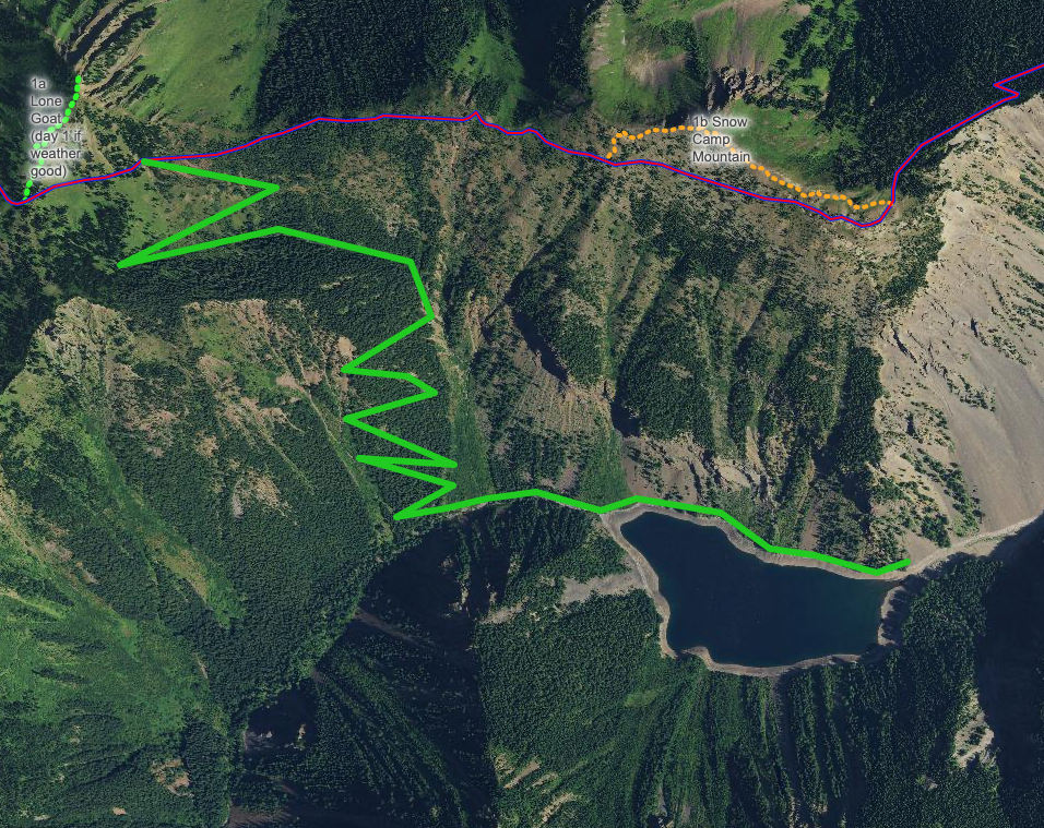
- Lake Cheakamus > Helm Creek > Panorama Ridge > Helm Creek (night) > Garibaldi Lake > Rubble Creek

- Lake Cheakamus > Helm Creek > Panorama Ridge > Helm Creek (night) > Lake Cheakamus

- Rubble Creek > Helm Creek > Panorama Ridge > Helm Creek (night) > Rubble Creek

I'm aware of the distance and difficulty of the trail, and this definitely won't be my first overnight trip (for context I've done 5040 Peak, Wedgemount lake, Bedwell/Cream lakes) and I'm happy to adapt my pace to the group.

Note: I was initially planning to rent a car (I don't have one yet ut have a BC license) but thought I'd ask around before doing so and be all by myself. Obviously I'll contribute to any cost involved for the trip up there. I've got all my camping/hiking gear otherwise. Any tips or recommendations I haven't thought of is also welcome, cheers!


r/vancouverhiking 2d ago

Gear Lost a pair of Smith Parallel Max sunglasses on August 31 North Shore Hike

1 Upvotes

On August 31 I lost a pair of Smith Parallel Max Sunglasses while hiking either up the Skyline trail or down the LGMH trail. Small reward offered if returned to me. Thx.


r/vancouverhiking 3d ago

Safety Garibaldi fire rescue team on the panorama ridge trail

13 Upvotes

Does anyone know why the Garibaldi fire team was on the Panorama ridge trail Aug 31st? We noticed them going up as we were on our way back to the parking lot


r/vancouverhiking 2d ago

Conditions Questions (See Guide before posting) Questions about the Armchair Traverse

7 Upvotes

Hello all. I'm looking to do the armchair traverse this coming Sunday. To those who did it:

How long did it take you? -I'm assuming a car to car time of 15 hours

Did you use any maps? I can't find the traverse route on all trails. My plan is to download the routes to cook and weart, and figure out the traverse part on my own.

How would you compare the difficulty of climbing compared to West Lion, Sky Pilot and Needle-Markhor Traverse?

Thanks to any and all answers.


r/vancouverhiking 3d ago

Safety Medical Emergency on High Note Trail (Sunday)

80 Upvotes

Yesterday (Sunday August 31), my friend and I hiked High Note Trail in Whistler. A little ways past Symphony Lake, we came across an older couple, who we had seen earlier on the trail. The man was sitting down on a large rock, and his wife was sitting in his lap, resting against him. Something seemed off and we asked if they were OK. They said they were fine, just resting, that the woman had felt faint and "blacked out".

At first they insisted they were fine and just needed to rest before completing the hike, but there was still an hour or so to go and the trail wasn't easy, and the woman did not look fine -- she was very pale. She then said that she couldn't see, everything was black.

My friend called emergency services, but unfortunately we could not remain with them as we needed to get back down to Whistler Village to catch our bus back to Vancouver. We felt awful for not being able to stay. But at least emergency services came fairly quickly -- they called my friend back.

I really hope the woman was OK -- it seemed like a pretty serious situation.


r/vancouverhiking 3d ago

Gear Vancouver free bear spray

23 Upvotes

Leaving Vancouver airport tommorrow, have some unused bear spray, wondering if anyone's around who wants it, or what to do with it if not. Thanks in advance!