r/dataisbeautiful • u/TA-MajestyPalm • 6d ago
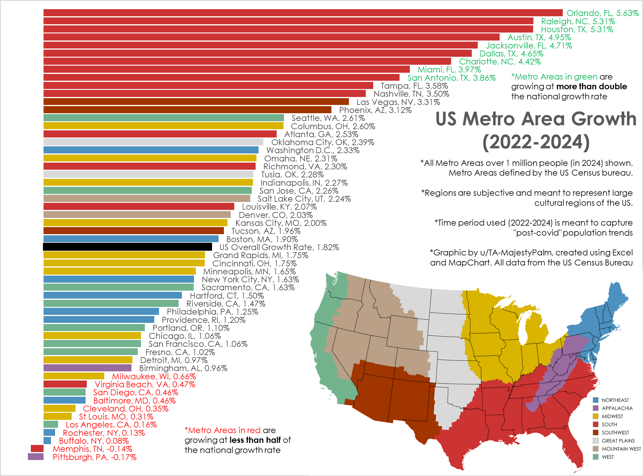
OC [OC] Post-Pandemic Population Growth Trends, by US Metro Area (2022->2024)
Graphic by me, created in Excel. All data from US Census here: https://www.census.gov/data/tables/time-series/demo/popest/2020s-total-metro-and-micro-statistical-areas.html
I've created similar graphics in the past, but usually from 2020-2024. This is not the best time frame as it combines the abnormal covid years with post pandemic movement.
This time frame (2022-2024) shows the most current and ongoing population trends of the last 2 years.
I also wanted to better categorize the cities into broad cultural regions vs the arbitrary geographic census regions.
879
Upvotes
21
u/hallese 5d ago
It's only weird because we're used to hand jamming entire states into regions. Nothing better exemplifies the distinct nature of Appalachia from the South than the existence of West Virginia. If you were to look at a light pollution map the boundaries would also make a lot more sense for Appalachia and as you move west from Midwest to Great Plains to Mountain West. When this gets further broken down Maine and New Orleans are often grouped together because of the shared history of the first European groups to settle in both regions.